
-
Get the news delivered directly to your phone. Click here to Join our WhatsApp Group
Tropical Storm Tammy Advisory Number 7 NWS National Hurricane Center Miami FL AL202023 1100 PM AST Thu Oct 19 2023 …
TAMMY SLOWING DOWN AND REORGANIZING… …TROPICAL STORM CONDITIONS AND HEAVY RAIN EXPECTED TO BEGIN TOMORROW FOR PORTIONS OF THE LEEWARD ISLANDS… SUMMARY OF 1100 PM AST…0300 UTC…INFORMATION ———————————————–


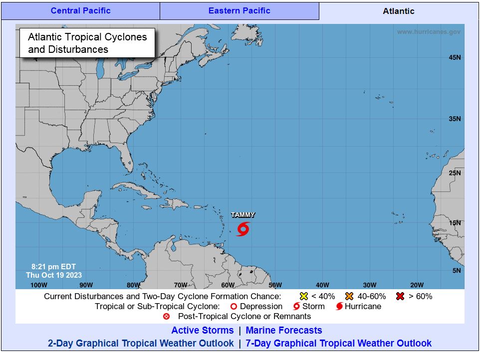
LOCATION…13.8N 57.1W ABOUT 165 MI…270 KM ENE OF BARBADOS ABOUT 270 MI…430 KM ESE OF MARTINIQUE MAXIMUM SUSTAINED WINDS…60 MPH…95 KM/H PRESENT MOVEMENT…WNW OR 290 DEGREES AT 10 MPH…17 KM/H MINIMUM CENTRAL PRESSURE…1001 MB…29.56 INCHES

WATCHES AND WARNINGS ——————– CHANGES WITH THIS ADVISORY:
The government of St. Maarten has issued a Hurricane Watch for St. Maarten. The government of France has issued a Hurricane Watch for St. Martin and St. Barthelemy.
SUMMARY OF WATCHES AND WARNINGS IN EFFECT: A Hurricane Watch is in effect for… * Guadeloupe * Antigua and Barbuda, Montserrat, St. Kitts and Nevis, and Anguilla * St. Maarten * St. Martin and St. Barthelemy A Tropical Storm Warning is in effect for… * Dominica * Guadeloupe * Antigua and Barbuda, Montserrat, St. Kitts and Nevis, and Anguilla * St. Maarten * St. Martin and St. Barthelemy

A Tropical Storm Watch is in effect for… * Barbados * Martinique * Saba and St. Eustatius A Hurricane Watch means that hurricane conditions are possible within the watch area. A watch is typically issued 48 hours before the anticipated first occurrence of tropical-storm-force winds, conditions that make outside preparations difficult or dangerous.
A Tropical Storm Warning means that tropical storm conditions are expected somewhere within the warning area within 36 hours. A Tropical Storm Watch means that tropical storm conditions are possible within the watch area, generally within 48 hours. Additional watches and warnings could be required tomorrow. For storm information specific to your area, please monitor products issued by your national meteorological service.
DISCUSSION AND OUTLOOK ———————-
At 1100 PM AST (0300 UTC), the center of Tropical Storm Tammy was located near latitude 13.8 North, longitude 57.1 West. Tammy is moving toward the west-northwest near 10 mph (17 km/h). A gradual turn to the northwest with some additional slowdown is forecast on Friday, and this motion should continue through Saturday. A more northward motion is forecast to begin Saturday night or Sunday.
On the forecast track, the center of Tammy will move near or over the Leeward Islands Friday and Saturday, and then move north of the Leeward Islands Saturday night and Sunday. Data from the NOAA reconnaissance aircraft indicate that the maximum sustained winds remain near 60 mph (95 km/h) with higher gusts. Gradual strengthening is expected to begin on Friday and continue into this weekend. Tammy is forecast to be at or near hurricane intensity when it moves near the Leeward Islands Friday night and Saturday. Tropical-storm-force winds extend outward up to 125 miles (205 km) from the center. The estimated minimum central pressure is 1001 mb (29.56 inches).
HAZARDS AFFECTING LAND ———————-
Tropical storm conditions are expected within the tropical storm warning area beginning tomorrow. Hurricane conditions are possible in portions of the Leeward Islands Friday night and Saturday. Tropical storm conditions are possible within the tropical storm watch area beginning tomorrow.
RAINFALL: Tammy is expected to produce the following storm total rainfall: Leeward Islands: 4 to 8 inches with maximum amounts of 12 inches Northern Windward Islands: 2 to 4 inches with maximum amounts of 6 inches British and U.S. Virgin Islands into eastern Puerto Rico: 1 to 2 inches with maximum amounts of 4 inches These rains may produce isolated flash and urban flooding, along with isolated mudslides in areas of higher terrain.

STORM SURGE: Storm surge could raise water levels by as much as 1 to 3 feet above normal tide levels near where the center of Tammy moves across the Leeward Islands.
SURF: Swells generated by Tammy will continue to affect portions of the Lesser Antilles during the next few days. These swells are likely to cause life-threatening surf and rip current conditions. Please consult products from your local weather office.
NEXT ADVISORY ————- Next intermediate advisory at 200 AM AST. Next complete advisory at 500 AM AST.
$$ Forecaster Papin
Аdvеrtіѕе wіth thе most visited news site in Antigua and Barbuda ~ Wе оffеr fullу сuѕtоmіzаblе аnd flехіblе dіgіtаl mаrkеtіng расkаgеѕ. Yоur соntеnt іѕ dеlіvеrеd іnѕtаntlу tо thоuѕаndѕ оf uѕеrѕ іn Antigua аnd аbrоаd via our One Signal push notifications! Соntасt uѕ аt [email protected].
———————————————————————
-
Get the news delivered directly to your phone. Click here to Join our WhatsApp Group
Make a donation to help support ABN, via PayPal: [email protected]. Follow Antigua Breaking News on X, formerly Twitter @ABNAntigua, and Instgram @AntiguaBreakingNews and on Facebook. Send us a message on WhatsApp at 1-868-704-9864 or email us at [email protected].
JOIN OUR WHATSAPP GROUP FOR NEWS UPDATES: CLICK HERE.
JOIN OUR WHATSAPP GROUP FOR NEWS UPDATES: CLICK HERE.
JOIN OUR WHATSAPP GROUP FOR NEWS UPDATES: CLICK HERE.
JOIN OUR WHATSAPP GROUP FOR NEWS UPDATES: CLICK HERE.
JOIN OUR WHATSAPP GROUP FOR NEWS UPDATES: CLICK HERE.
JOIN OUR WHATSAPP GROUP FOR NEWS UPDATES: CLICK HERE.
JOIN OUR WHATSAPP GROUP FOR NEWS UPDATES: CLICK HERE.
JOIN OUR WHATSAPP GROUP FOR NEWS UPDATES: CLICK HERE.
JOIN OUR WHATSAPP GROUP FOR NEWS UPDATES: CLICK HERE.
JOIN OUR WHATSAPP GROUP FOR NEWS UPDATES: CLICK HERE.
JOIN OUR WHATSAPP GROUP FOR NEWS UPDATES: CLICK HERE.
JOIN OUR WHATSAPP GROUP FOR NEWS UPDATES: CLICK HERE.