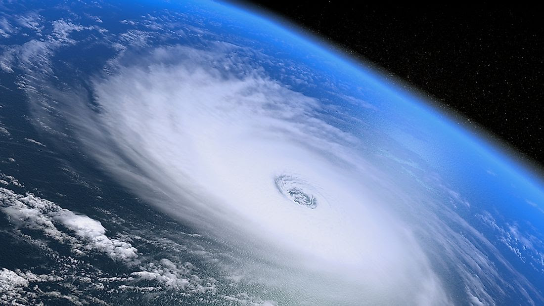

AccuWeather meteorologists recently put the final touches on their initial forecast for the upcoming Atlantic hurricane season, and they are emphasizing that preparations should begin in earnest even though the official start date is two months away.
Mother Nature threw a bit of an atmospheric curveball in 2022 despite the presence of a moderate to strong La Niña.


The Atlantic generated no named storms in August, but three hurricanes roamed the basin in November.

The overall number of named storms was 14, which is average and a much lower number than what the prolific 2020 and 2021 seasons produced.
So what does 2023 have in store? According to AccuWeather’s team of tropical weather forecasters, it will be less active than the majority of seasons since 1995 and may feature a similar number of storms when compared to 2022. But that doesn’t mean there won’t be dangers.
Current projections indicate that the 2023 season will be near the historical average with 11-15 named storms.

Four to eight of those named storms are expected to reach hurricane strength, with one to three of those hurricanes achieving major hurricane status.
A major hurricane is one that has maximum sustained winds of 111 mph or greater and is rated 3-5 on the Saffir-Simpson Hurricane Wind Scale.

“We are also projecting two to four direct impacts on the United States, including Puerto Rico and the Virgin Islands,” said Senior Meteorologist and Hurricane Expert Dan Kottlowski, who has been issuing forecasts for AccuWeather for over four decades.
Based on the 30-year average from 1990 to 2020, a typical hurricane season consists of 14 named storms, seven hurricanes, three major hurricanes and four direct impacts on the U.S.
The 2023 forecast was crafted meticulously and took a number of critical environmental factors into account. A few of the factors that will influence the season include the expected transition to El Niño, sea surface temperatures in the tropical hotbeds of the Atlantic and the strength of a wind pattern over Africa known as the African easterly jet. Continue reading for a comprehensive analysis of how the season is expected to play out and why.
Goodbye La Niña, hello El Niño?
In early March, NOAA’s Climate Prediction Center (CPC) declared an end to the “triple-dip” La Niña that was in place through the past three hurricane seasons. The hyperactive 2020 season produced a record-setting number of named storms with 30, while it was followed by 21 more in the extremely busy 2021 season.
During a La Niña phase, vertical wind shear becomes less prevalent over the traditional breeding grounds for tropical storms and hurricanes. Wind shear can inhibit a tropical cyclone’s formation, so when there is less wind shear in the atmosphere forecasters tend to predict a higher number of tropical systems to develop when issuing seasonal prognostications.
With El Niño, it’s the opposite.
An El Niño pattern causes the winds at higher levels of the atmosphere to dip southward and deep into the tropics more frequently, resulting in more episodes of vertical wind shear. Vertical wind shear causes thunderstorms and convective clouds within emerging tropical disturbances to be tilted, disrupting tropical development, Kottlowski explained.

This graphic illustrates the general trends in the tropics when an El Niño pattern is fully underway.
La Niña and El Niño make up two-thirds of the broader three-pronged recurring climate pattern known as the El Niño Southern Oscillation (ENSO). The third phase is ENSO-neutral.
As of March 29, the CPC said an ENSO-neutral phase was in effect, meaning sea surface temperatures across the equatorial East Pacific were right around historical averages. Over the next four to six months, AccuWeather meteorologists expect the waters south of Hawaii and along both sides of the equator to warm to levels above the historical average. As a result, an evolving El Niño is likely to unfold by the second half of the summer. However, there remains a question about how strong El Niño will be from late August to early October, which is historically when tropical activity is at its highest.
Hurricane seasons with emerging El Niño patterns tend to be less active than normal, Kottlowski stated.But, there can still be some windows where favorable conditions develop across parts of the basin for tropical development to take place.
There are many breeding grounds for tropical cyclones in the Atlantic, including the Caribbean, Gulf of Mexico and along the Atlantic coast of the U.S. During the heart of the hurricane season, the far eastern Atlantic off the coast of Africa is another hot spot. Tropical waves, which are areas of low pressure in the atmosphere, are pushed from the deserts of northern Africa into the Atlantic, where they often quickly organize into robust tropical cyclones.

The strength of the African easterly jet usually plays a big role in the number of tropical waves that enter the Atlantic from Africa. The impending arrival of El Niño, however, is expected to result in a weaker African easterly jet, thus resulting in fewer tropical waves emerging off the African coast.
Which parts of the United States will be at the greatest risk?

A satellite image showing Hurricane Ian just after it reached Category 2 force on Monday, Sept. 26, 2022.
Instead, Florida, Puerto Rico and South Carolina endured the worst of 2022, which included strikes from menacing tempests such as hurricanes Ian and Fiona in September then Nicole, which made a rare late-season landfall on Florida’s east coast in November.Unfortunately for those in the Sunshine State who are still recovering from those punishing hurricanes, AccuWeather forecasters say the state will once again be at a higher risk than other parts of the country.

Homes are flooded on Salinas Beach after the passing of Hurricane Fiona in Salinas, Puerto Rico, Monday, Sept. 19, 2022.
“Based on climatology and an evolving El Niño pattern during August through October, the highest chance for direct and significant impacts will be from the Florida Panhandle around the entire state of Florida to the Carolina coast,” Kottlowski said. “There appears to be a lower chance for direct impacts over the western Gulf of Mexico and for the Northeast U.S.”
AccuWeather forecasters were able to determine areas at most significant risk in part based on analog years, which are past years that bear similarities to current and expected weather patterns. Some recent analog years for this year’s forecast include 2006 (below-average amount of Atlantic storms), 2009 (below average), 2012 (above average) and 2018 (above average).The 2012 season was memorable for the late-season landfall of Superstorm Sandy and its devastating effects in the mid-Atlantic, while 2018 was defined by the historic deluge unleashed on the Carolinas by Hurricane Florence and the intense force of Category 5 Hurricane Michael on the Florida Panhandle.
Another key determinant in the locations where storms make landfall each year is an area of high pressure over the Atlantic known as the Bermuda Azores high. The orientation of this high-pressure area can dramatically alter a storm’s track.

A weaker Bermuda high typically allows storms to recurve away from the United States. But stronger ones have the opposite effect and can guide storms closer to U.S. shores. As of March 29, Kottlowski’s team says the strength of the Bermuda high will be one of the biggest storylines to monitor throughout the season.
Above-normal water temperatures will once again play a major role
Preseason tropical activity has been a common occurrence over the past decade, but in 2022, there were no named storms before the official June 1 start date for the first time since 2014.
Kottlowski believes that there is a good chance for preseason development once again this year, due in large part to warm waters in the Gulf of Mexico and off the Southeast coast of the U.S., the locations where storms typically form in the late spring and early summer in the basin.
Waters were already warmer than average in the Gulf of Mexico as of late March and have played a big role in the active start to the severe weather year in the United States.

Water temperatures across the Caribbean and Gulf of Mexico as of March 27, 2023.
The unusually warm waters could once again provide the fuel necessary for a storm to intensify rapidly into a major hurricane. And as Ian proved, it only takes one storm to affect millions of lives.
“Even if this season were to turn out to be less active than normal, abundant warm water could lead to the development of a couple of very strong hurricanes, as we saw with Ian,” Kottlowski said. “Anyone living near or at the coast must have a hurricane plan in place to deal with what could be a life-threatening or very damaging hurricane. Now is the time to create or update your plan.”
Hurricane season officially ends on Nov. 30, and in 2022, the season finished with an active November. However, due to the anticipated arrival of El Niño, the chances for late-season development this year during November and even December will be low.
Will this be an intense season?
Accumulated cyclone energy (ACE) is a way to measure a tropical cyclone’s intensity as well as its longevity. Adding up every storm’s ACE value can help meteorologists define the season as a whole. An average value for any given season is between 80 and 130 ACE units.
Some seasons that have more named storms can end up having lower overall ACE values than those with fewer storms. For instance, although 2020 had more named storms on record than any other with 30, its ACE value of 179.8 was lower than years such as 2017 (224.9) and 2005 (245.3), according to Colorado State University figures. The 2005 season had 28 named storms, and the 2017 season had 17.
“Last year produced 95 ACE units, and this year is expected to be very similar, in other words, near-normal ACE,” Kottlowski said. Specifically, AccuWeather is calling for a total ACE between 75 and 105 this year.

Hurricane safety plans should be made now, not in June
Experts emphasize that it’s never too early to organize a hurricane-safety strategy, and it’s not just residents who live directly along the coast that must be mindful. Kottlowski said people living within 100 miles of the coastline should be taking action now too.
Recent studies have found that hurricanes are maintaining their strength for longer periods of time after landfall, causing more significant flooding and wind damage farther inland.
And it’s not just hurricanes. A high-end tropical storm can also unleash life-threatening impacts, with Tropical Storm Imelda’s devastating flooding in Texas in 2019 being one example.
Steps to take toward making yourself as hurricane ready as possible include studying local evacuation routes, organizing an emergency preparedness kit, mitigating opportunities for damage around your property and conducting a checkup on your insurance plans.
Make a donation to help support ABN, via PayPal: [email protected]. Follow Antigua Breaking News on Twitter @ABNAntigua and Instgram @AntiguaBreakingNews and on Facebook. Send us a message on WhatsApp at 1-868-704-9864 or email us at [email protected].
CLICK HERE TO JOIN OUR WHATSAPP GROUP FOR NEWS UPDATES. CLICK HERE TO JOIN OUR WHATSAPP GROUP FOR NEWS UPDATES. CLICK HERE TO JOIN OUR WHATSAPP GROUP FOR NEWS UPDATES. CLICK HERE TO JOIN OUR WHATSAPP GROUP FOR NEWS UPDATES. CLICK HERE TO JOIN OUR WHATSAPP GROUP FOR NEWS UPDATES.
CLICK HERE TO JOIN OUR WHATSAPP GROUP FOR NEWS UPDATES. CLICK HERE TO JOIN OUR WHATSAPP GROUP FOR NEWS UPDATES. CLICK HERE TO JOIN OUR WHATSAPP GROUP FOR NEWS UPDATES. CLICK HERE TO JOIN OUR WHATSAPP GROUP FOR NEWS UPDATES. CLICK HERE TO JOIN OUR WHATSAPP GROUP FOR NEWS UPDATES.
CLICK HERE TO JOIN OUR WHATSAPP GROUP FOR NEWS UPDATES. CLICK HERE TO JOIN OUR WHATSAPP GROUP FOR NEWS UPDATES. CLICK HERE TO JOIN OUR WHATSAPP GROUP FOR NEWS UPDATES. CLICK HERE TO JOIN OUR WHATSAPP GROUP FOR NEWS UPDATES. CLICK HERE TO JOIN OUR WHATSAPP GROUP FOR NEWS UPDATES.
CLICK HERE TO JOIN OUR WHATSAPP GROUP FOR NEWS UPDATES. CLICK HERE TO JOIN OUR WHATSAPP GROUP FOR NEWS UPDATES. CLICK HERE TO JOIN OUR WHATSAPP GROUP FOR NEWS UPDATES. CLICK HERE TO JOIN OUR WHATSAPP GROUP FOR NEWS UPDATES. CLICK HERE TO JOIN OUR WHATSAPP GROUP FOR NEWS UPDATES.
CLICK HERE TO JOIN OUR WHATSAPP GROUP FOR NEWS UPDATES. CLICK HERE TO JOIN OUR WHATSAPP GROUP FOR NEWS UPDATES. CLICK HERE TO JOIN OUR WHATSAPP GROUP FOR NEWS UPDATES. CLICK HERE TO JOIN OUR WHATSAPP GROUP FOR NEWS UPDATES. CLICK HERE TO JOIN OUR WHATSAPP GROUP FOR NEWS UPDATES.
CLICK HERE TO JOIN OUR WHATSAPP GROUP FOR NEWS UPDATES. CLICK HERE TO JOIN OUR WHATSAPP GROUP FOR NEWS UPDATES. CLICK HERE TO JOIN OUR WHATSAPP GROUP FOR NEWS UPDATES. CLICK HERE TO JOIN OUR WHATSAPP GROUP FOR NEWS UPDATES. CLICK HERE TO JOIN OUR WHATSAPP GROUP FOR NEWS UPDATES.
CLICK HERE TO JOIN OUR WHATSAPP GROUP FOR NEWS UPDATES. CLICK HERE TO JOIN OUR WHATSAPP GROUP FOR NEWS UPDATES. CLICK HERE TO JOIN OUR WHATSAPP GROUP FOR NEWS UPDATES. CLICK HERE TO JOIN OUR WHATSAPP GROUP FOR NEWS UPDATES. CLICK HERE TO JOIN OUR WHATSAPP GROUP FOR NEWS UPDATES.
CLICK HERE TO JOIN OUR WHATSAPP GROUP FOR NEWS UPDATES. CLICK HERE TO JOIN OUR WHATSAPP GROUP FOR NEWS UPDATES. CLICK HERE TO JOIN OUR WHATSAPP GROUP FOR NEWS UPDATES. CLICK HERE TO JOIN OUR WHATSAPP GROUP FOR NEWS UPDATES. CLICK HERE TO JOIN OUR WHATSAPP GROUP FOR NEWS UPDATES.
CLICK HERE TO JOIN OUR WHATSAPP GROUP FOR NEWS UPDATES. CLICK HERE TO JOIN OUR WHATSAPP GROUP FOR NEWS UPDATES. CLICK HERE TO JOIN OUR WHATSAPP GROUP FOR NEWS UPDATES. CLICK HERE TO JOIN OUR WHATSAPP GROUP FOR NEWS UPDATES. CLICK HERE TO JOIN OUR WHATSAPP GROUP FOR NEWS UPDATES.
CLICK HERE TO JOIN OUR WHATSAPP GROUP FOR NEWS UPDATES. CLICK HERE TO JOIN OUR WHATSAPP GROUP FOR NEWS UPDATES. CLICK HERE TO JOIN OUR WHATSAPP GROUP FOR NEWS UPDATES. CLICK HERE TO JOIN OUR WHATSAPP GROUP FOR NEWS UPDATES. CLICK HERE TO JOIN OUR WHATSAPP GROUP FOR NEWS UPDATES.


One response to “2023 hurricane season will be near the historical average with 11-15 named storms”
When man a plan,God is showing us signs, and wonders both on earth,and heaven above.